


 118 / 234

Ireland’s Environment – An Assessment 2016
114
Responses
Spatial Planning
Good planning decisions are those that are
integrated and also provide for a better environment.
Spatial planning strongly influences land use. Good planning
decisions can incentivise more efficient resource use in the
built environment and avoid the intrusion of inappropriate
urban infrastructure into natural areas. According to the
European Environment Agency’s State of the Environment
report (EEA, 2015), integrated spatial planning
“
can optimise
economic development opportunities, ecosystem services,
reduce human exposure to environmental pressures and reduce
social inequities … the challenge is to design a future urban
environment with public appeal while meeting the needs of
the population”. The importance of clean and well-protected
“green” and “blue spaces” such as parks, ponds and wild
areas in the urban landscape is now recognised as a key part of
urban landscapes that are needed for healthy communities. The
real benefits of these areas to health are covered in Chapter 8.
Land Cover Mapping
Mapping at greater resolution is needed to pick out
local issues.
Addressing the national level resolution gap in land cover
mapping remains a challenge and requires collaboration
between many organisations and government
departments. An EPA study in 2010 (G. Smith, EPA,
December 2010, personal communicationz) found that
there is still a need for a national high-resolution (1–5
ha scale) land cover dataset to characterise and assess
LULC adequately, as small areas of biodiversity, water
bodies and rural/one-off housing are indiscernible at a
25 ha scale. At an EU level, Action 5 of the EU Biodiversity
Strategy (EC, 2011) calls on Member States to map
and assess the state of ecosystems and their services.
A dedicated EU working group has been established to
deliver this action.
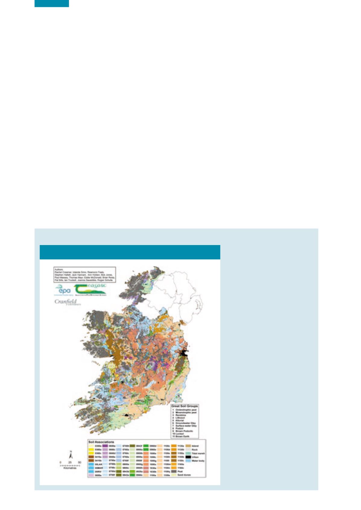
Irish Soil Information System
Figure 7.5
National Soil Map of Ireland (Source: EPA, 2014b)
Since the last EPA State of the
Environment report in 2012
was published, availability of
soil data has increased. One
area which has seen significant
improvement has been the
establishment of a national soil
map as part of the EPA-funded
Irish Soil Information System
Project, published in 2014.
The overall objective of
this project, undertaken by
Teagasc, Cranfield University
and University College Dublin,
was to assess the national
distribution of soil types and
prepare a national soil map
that would identify and classify
soils using a consistent national
classification. In addition to
the map, a collection of tools
to access and interact with
the soils data were developed.
The various soil types have
been assessed taking into
account their environmental
and agronomic responses. This
should assist soils management
planning and related policy
implementation. This map is
now publicly available at:
http://gis.teagasc.ie/soils/ .