


 112 / 234

Ireland’s Environment – An Assessment 2016
108
The Current Situation
Land Use and Land Cover
The interactions between land use and land cover
shape our environment.
The interactions between human activity, such as farming,
forestry and the built environment, are interlinked with
processes that shape the environment, landscape and
biodiversity of the country. Land cover describes what is
visible on the land surface. Land use describes the use(s) the
land has been put to from a human perspective. CORINE is
a pan-European land use and land cover (LULC) mapping
programme and is the main source of national-scale LULC
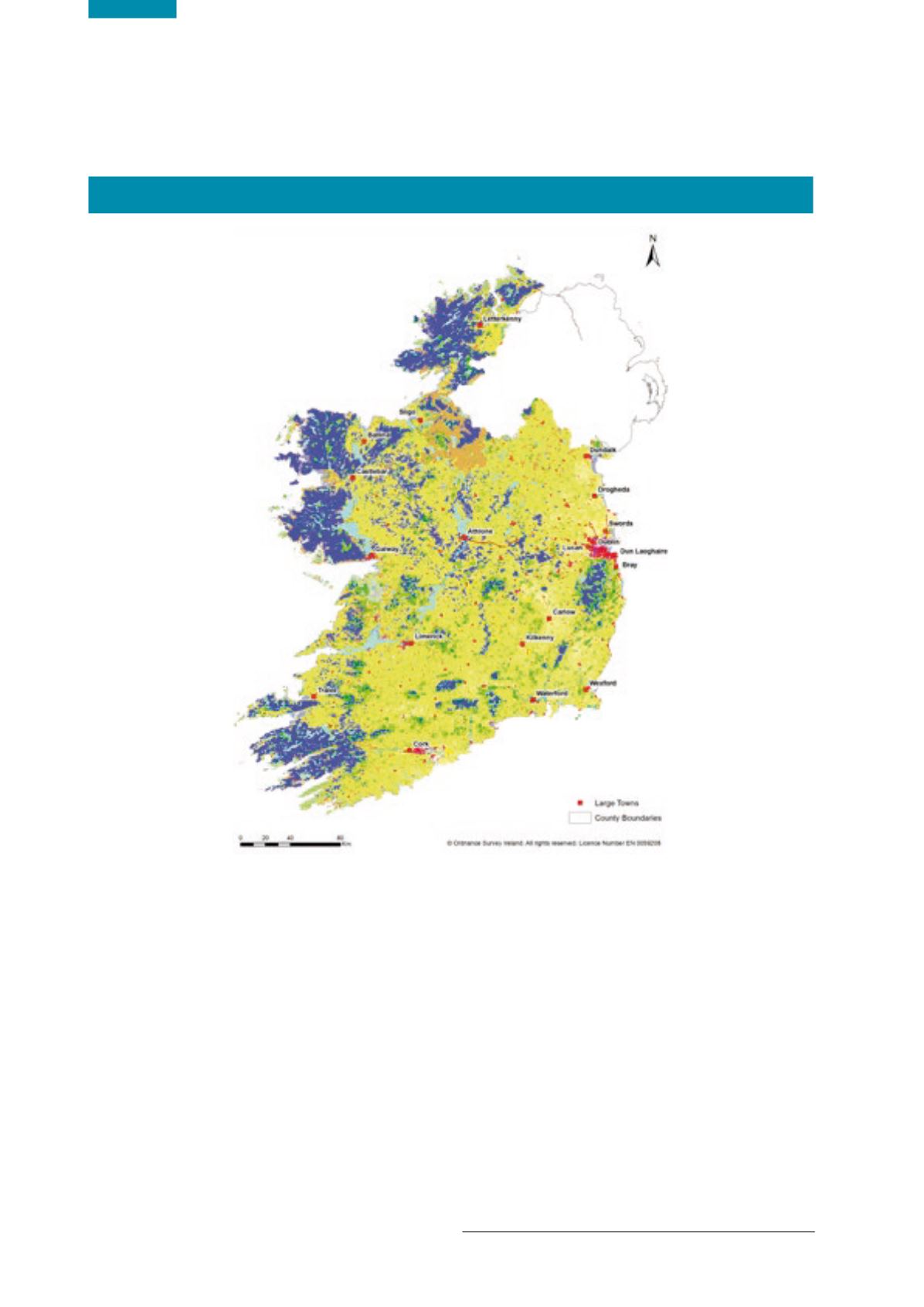
information. The most recent assessment in 2012 shows
that agriculture is the primary LULC type within Ireland
(67.36% national land cover), followed by wetlands
(15.56%) and forestry (9.37%) (Figure 7.1 and Table 7.1).
Land Cover and Land Use Datasets
More detailed mapping will improve the knowledge
base and decision-making capability.
No single detailed integrated national baseline LULC dataset
currently exists in Ireland. The existing data either lack the
appropriate resolution (e.g. CORINE
1
) or are sector-specific
subsets of the data produced by various agencies (e.g.
forestry data produced by the Forest Service). A national
working group is developing a co-ordinated national
mapping programme to address this gap. This programme
will be essential to monitor, report and assess the
environmental impacts of different land cover and land uses.
This is illustrated in the water environment, where LULC
can, for example, influence susceptibility to flooding and its
impact on water quality and water-related ecosystems.
1 Co-ORdinated INformation on the Environment.
Figure 7.1
CORINE 2012 Land Use and Land Cover Map (Source: EPA GIS stock)