Basic HTML Version


Ireland’s Environment 2012
88
Under the Water Framework
Directive, water quality sites of high
status must be maintained. These
sites are particularly sensitive to
pressures and their high status can
be lost from relatively low level (small
area) changes in land use including
reclamation of land, agricultural
intensification and house building
(see also Chapter 4). An EPA-funded
research project is under way to
provide information and guidance
on protecting these high-status sites
(EPA, 2012a).
A diverse range of providers
contribute to the collation and
analysis of land cover and land
use data in Ireland; however, there
is no clear mandated authority
with overall responsibility for the
task. It is challenging to present
a consistent analysis of change
across the entire landscape, and
the need for improved coordination
and integration of LULC mapping
activities is widely recognised within
the environmental sector. A study
by the EPA in 2010 found that there
is a pertinent need for a national
high-resolution (1–5 ha scale) land
cover dataset specially designed to
characterise Irish LULC adequately.
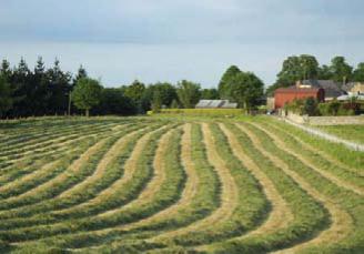
Agriculture
Agriculture remains the largest use
of land in Ireland, with two-thirds of
land devoted to it. Most of this land
is under grass for pasture, silage or
rough grazing.
Food Harvest 2020
(DAFF, 2010)
projects significant changes in
production, particularly in the dairy
sector, with a consequent increase
in livestock. It is anticipated that
much of this will be achieved
through changing farm management
and resource use with minimal
changes to land cover. Nonetheless,
integration of environmental
considerations with the agricultural
objectives must be carefully managed
from the start to prevent negative
impacts on soil quality and water
quality.
Peatland
Almost one-fifth of land in Ireland is
categorised as peatland; this includes
raised bogs, blanket bogs and fens.
They are important ecosystems
sustaining a range of animal and
plant species. The EPA STRIVE-funded
BOGLAND study on sustainable
management of peatland in Ireland
(Renou-Wilson et al., 2011) found
that up to 95% of all peatland
exists in a degraded state, with the
worst damage sustained in the 20th
century. Peatland continues to be
disturbed by domestic and industrial
peat extraction, afforestation, wind
farms, recreational activities and
invasive species.
Natural peatland acts as a long-
term carbon store; however, when
peatland is damaged this function
is reversed and carbon is released
to the environment. Release of
terrestrial carbon from soil and
biomass is a major source of carbon
dioxide (CO
2
), the main contributor
to climate change. Globally, it is
estimated that 25% of the current
elevated atmospheric concentration
of CO
2
is due to historic land use
change, primarily deforestation of
land for agriculture. The BOGLAND
study estimated that Irish peatland
releases carbon at the rate of 9.66
Mt CO
2
equivalents per year.
The degradation of Irish peatland
has caused a loss of biodiversity at
both regional and national levels.
The BOGLAND study found evidence
of loss of species, loss of habitats and
loss of entire ecosystems represented
by the damage to almost all raised
bogs and fens. In 2010 the European
Commission began infringement
proceedings against Ireland in
relation to continued turf cutting
on bogs designated as Special Areas
of Conservation. The Government
has banned turf cutting in these
areas and offered compensation to
those affected. Damage to peatland
impacts on water quality due to
silt release from mechanical peat
harvesting, increased nutrient release
from drained bogs and increased
acidification from afforestation on
bogs.
The industrial extraction of peat for
energy and horticultural purposes is
likely to decline over the next 15–20
years. This is due to the gradual
harvesting and depletion of peat
from existing industrial cutover
bogs, and the limited scope for
development of new peatland areas